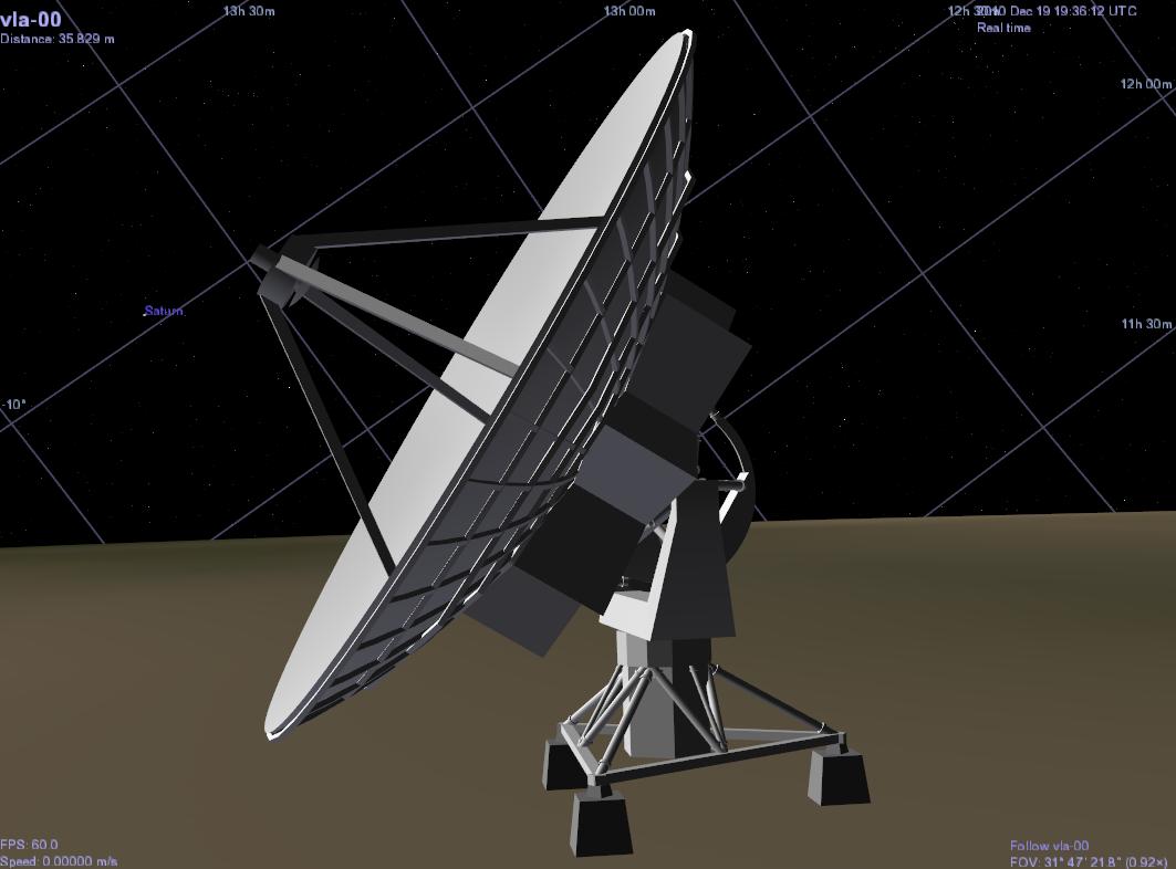
VLA telescope |
|
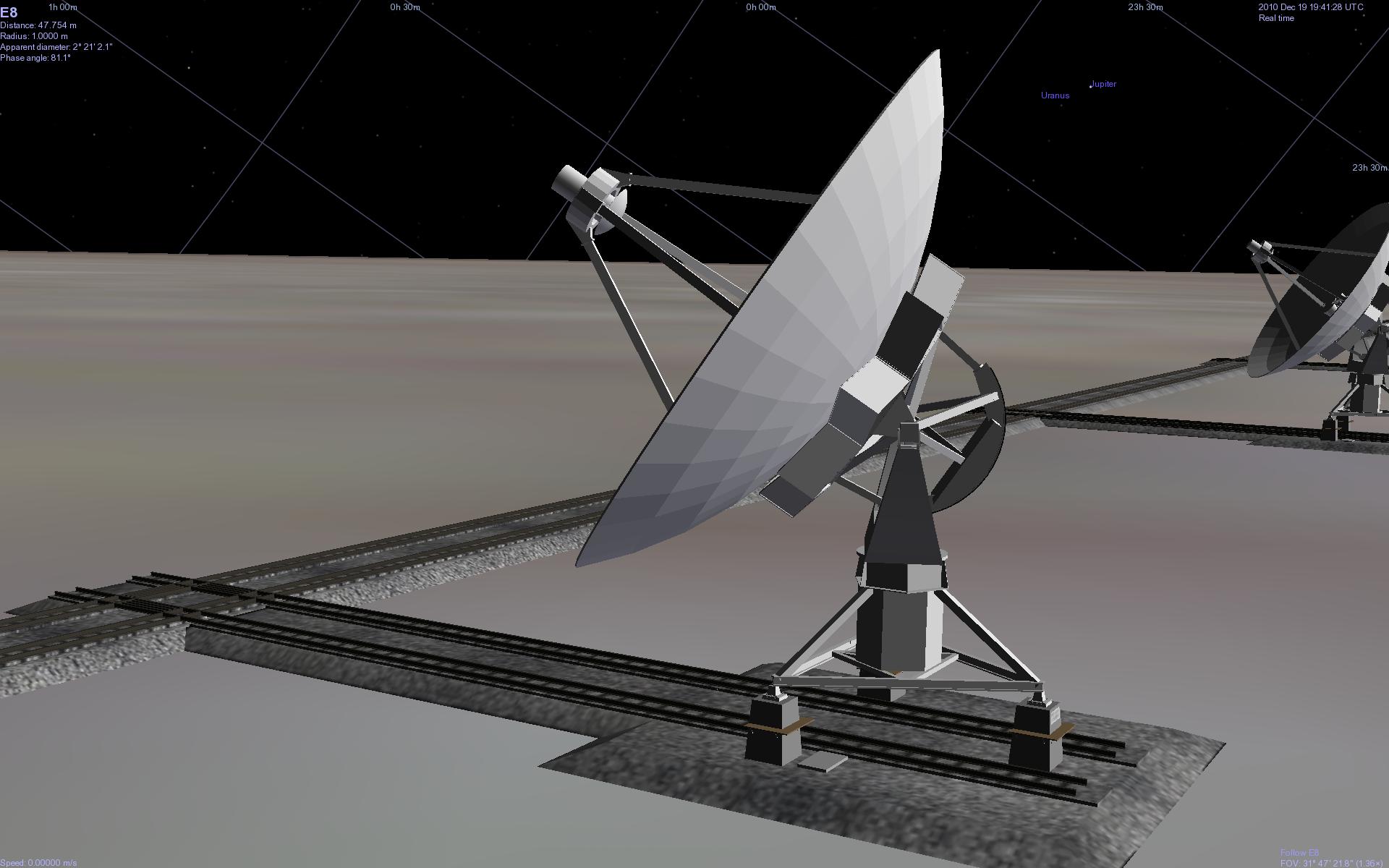
Lores EVLA telescope |
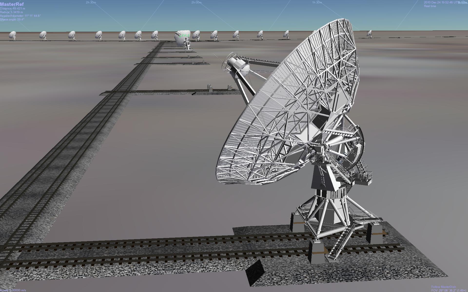
Medium res EVLA telescope |
The Very Large Array (Now the Epanded VLA) of radio telescopes is located in the Plains of San Agustin (St. Augustine), west of Socorro, New Mexico.
Below are a simple model representing one of the VLA telescopes plus a more elaborate Addon showing the layout of the whole Array. They were developed using pictures seen on the VLA Web site at https://www.vla.nrao.edu/
These Addons were created for use with Celestia v1.6.0 or later.
Celestia is a free 3D astronomical visualization program. More information about Celestia is available at https://celestia.space/
Celestia v1.6.1 for Windows, MacOS X and Linux is available at https://sourceforge.net/project/showfiles.php?group_id=21302
If you restore one of these Zip files into Celestia's Extras directory, it should recreate all of the directories and files necessary for the Addon to work with Celestia v1.6.0 or later.
Warning: Restore only one of these Addons at a time. The simplistic v1 Addon conflicts with the more elaborate EVLA version.
The included HTML (Web) file contains Cel:// URLs which will take you to viewpoints near the telescopes.
For more information about the Addons, be sure to read their "readme" files.
|
VLA telescope |
|
|
Lores EVLA telescope |
Medium res EVLA telescope |
The v1 model of the telescope is highly simplified.
The SSC catalogs for both Addons were created for Celestia v1.6.0. They cannot work with earlier versions of Celestia and may need to be modified for use with later versions.
The SSC files sometimes load in the wrong order on some Linux systems, and maybe on Macs. If things don't look right and you see reference frame errors in the log, then combine the three SSC catalogs into one and eliminate the originals:
The telescope models always point toward their designated targets, even if they're below the horizon, which is physically impossible. Maybe in a future version they'll turn only when the target is above the horizon.
The v1 model seems to be floating in the air 2.1km above the surface since no DEM of the local terrain is included. The EVLA models are placed on a flat map which is at the correct altitude of 2.1 km above sealevel. As a result, that map seems to be floating in air above Celestia's Earth, which has its surface all at sealevel.
The models were derived from images available at https://www.vla.nrao.edu/
The models included in this Addon were created using Anim8or, a free 3D design program written by Steve Glanville. Visit https://www.anim8or.com/ for more information.
See the readme files in the Addons for additional credits.
These Addons for Celestia were created by Selden Ball. V1 is Copyright © December, 2010. EVLA is Copyright © April, 2011. All rights reserved.
These Addons may be freely redistributed for educational purposes. They may not be used for any commercial benefit without explicit written permission from the author.
If you don't tell me that something's missing, unclear or wrong, I can't improve it.